Your city’s green,cared forby those who live it.
One photo, and the AI recognizes the plant, certifies its health and estimates the impact, feeding the green census municipalities already have to produce by law.
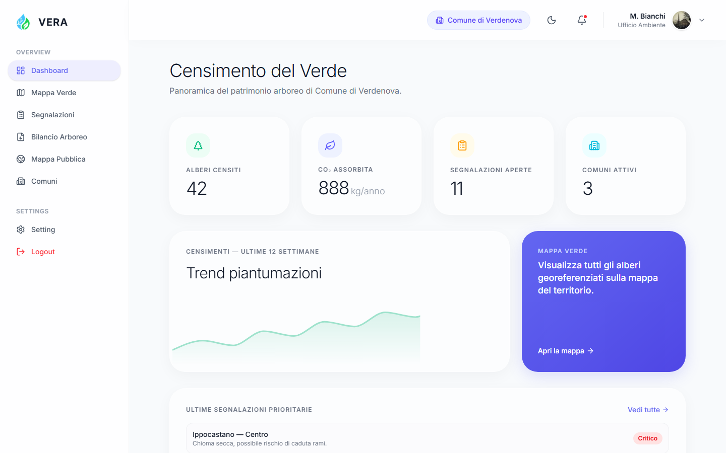
Everything you need, from photo to report.
The dashboard your technical office will use every day, not another platform to learn.
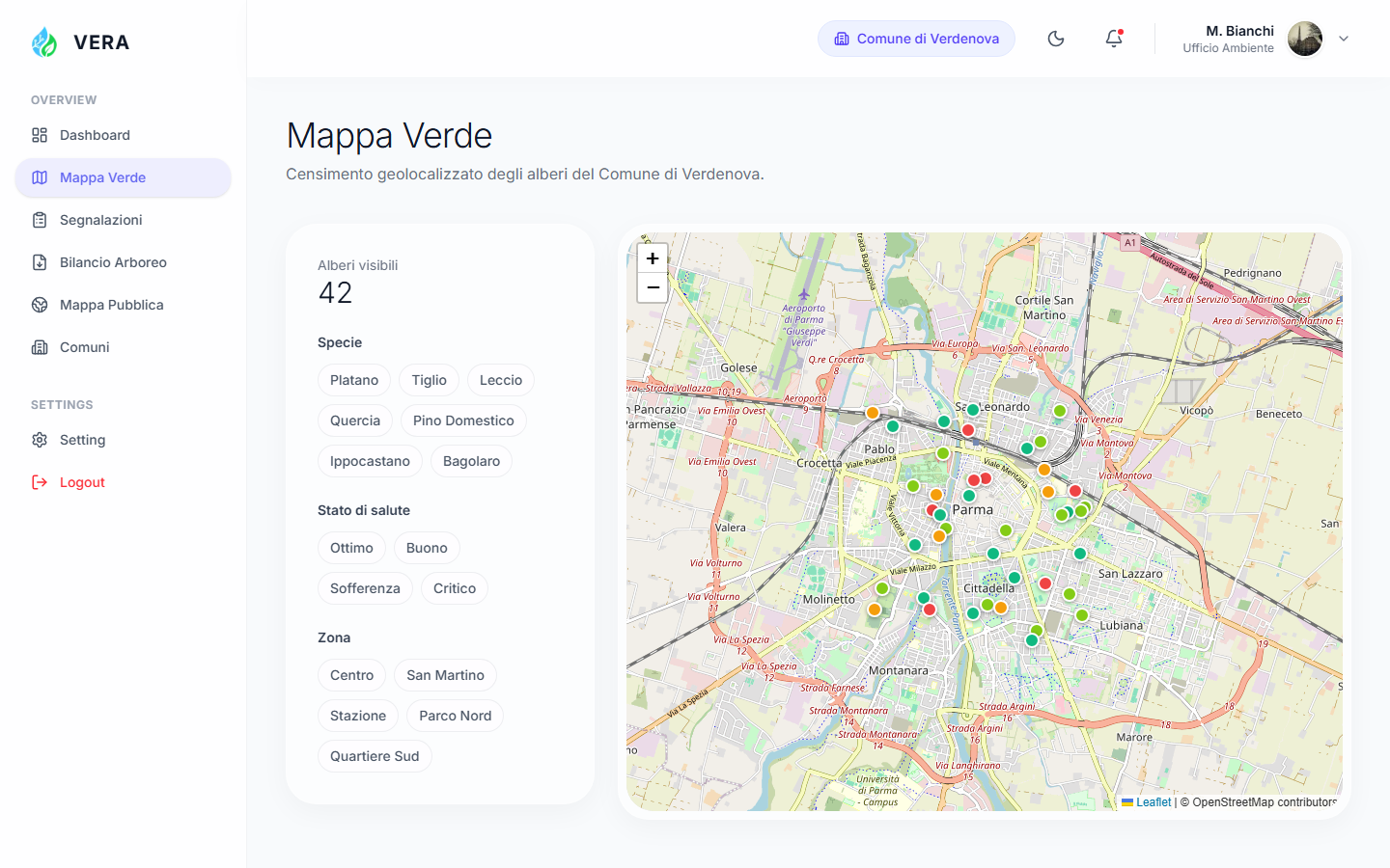
Green Map
Every tree geo-referenced, filterable by species, health status and area. Click a marker, see the full record.
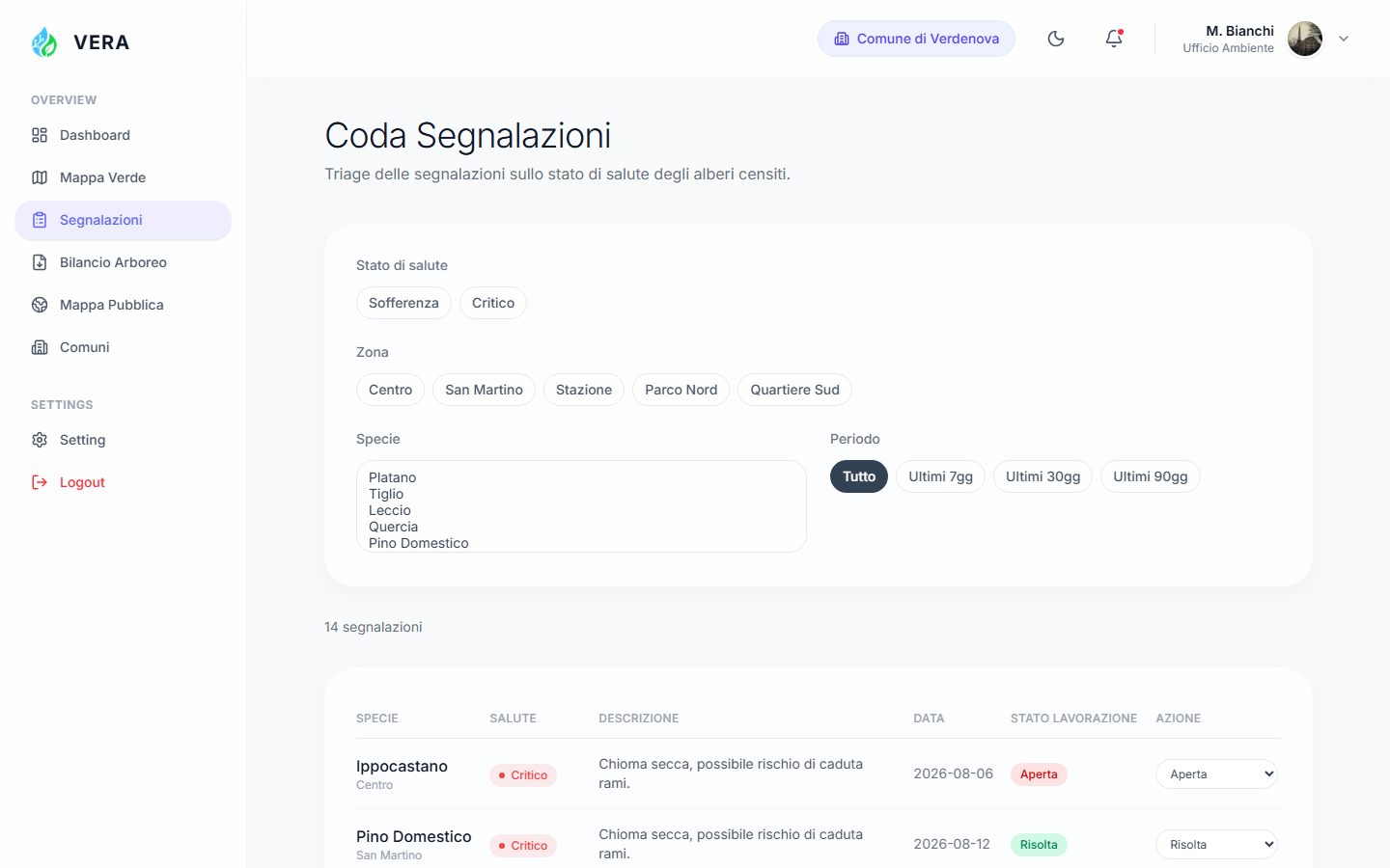
Report Queue
Critical reports automatically move to the top. Change the status in one click, no more scattered emails.
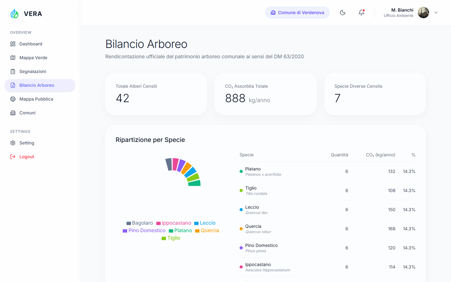
Tree Balance Report
The document required by DM 63/2020, ready to attach to a resolution. Export in PDF, CSV and GeoJSON.
From photo to official census.
The citizen takes a photo
~15 seconds, free. The only action required from those who live the city, no app to configure, no course to follow.
The AI recognizes and measures
Species, health status and estimated CO₂ absorption calculated automatically; every shot is geo-referenced.
The municipality gets the dashboard
Report queue, map and tree balance already ready, instead of a technical survey to commission at a high price.
Real-time census
LiveBuilt for those who really have to manage green space.
Not just another regulatory deadline: a tool your office will actually use.
"The green census is an obligation we kept postponing due to budget. With citizens generating the data, it becomes sustainable."
"I survey a tree in seconds instead of minutes, and the data is already ready for the client’s tree balance report."
"Reports no longer arrive through scattered emails: I have a single, prioritized queue, with processing status."
The census you already needed.
Ready in under an hour.
No tender, no months-long procurement. Activate your municipality and start receiving geo-referenced reports from day one.